
Tamanho desta previsualização: 800 × 534 pixels. Outras resoluções: 320 × 214 pixels | 640 × 427 pixels | 1 024 × 683 pixels | 1 500 × 1 001 pixels.
Imagem numa resolução maior (1 500 × 1 001 pixels, tamanho: 644 kB, tipo MIME: image/jpeg)
| Descrição |
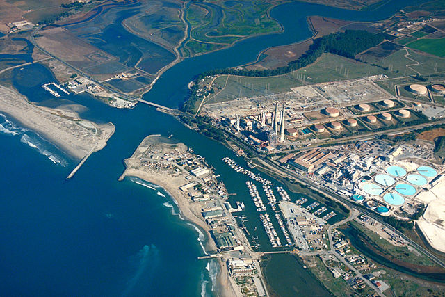
English: Aerial view of Moss Landing, Monterey County, California, USA. The Elkhorn slough runs the area and about 6 miles (8 km) inland. The huge Moss Landing Power Plant is visible at the center.
Coordinates: 36°48′21.95″N 121°46′57.55″W / 36.8060972°N 121.7826528°W |
|||
| Local | Moss Landing, Monterey County, California, USA | |||
| Data | not specified or unknown | |||
| Fonte |
U.S. Army Corps of Engineers Digital Visual Library Image page Image description page Digital Visual Library home page |
|||
| Autor | U.S. Army Corps of Engineers, photographer not specified or unknown | |||
| Permissão (Reutilizando este arquivo) |
|
Histórico do arquivo
Clique em uma data/horário para ver como o arquivo estava em um dado momento.
| Data e horário | Miniatura | Dimensões | Usuário | Comentário | |
|---|---|---|---|---|---|
| atual | 01h35min de 4 de maio de 2007 | | 1 500 × 1 001 (644 kB) | wikimediacommons>DanMS | {{Information | Description = {{en|Aerial view of Moss Landing, Monterey County, California, USA. The Elkhorn slough runs the area and about 6 miles (8 km) inland. The huge Moss Landing Power Plant is visible at the center. }} Coordinates: {{Coor dms| |
Uso do arquivo
As seguinte página usa este arquivo:
 " class="attachment-atbs-s-4_3 size-atbs-s-4_3 wp-post-image" alt="O que estudar para o enem 2023">
 " class="attachment-atbs-s-4_3 size-atbs-s-4_3 wp-post-image" alt="Qual melhor curso para fazer em 2023">
 " class="attachment-atbs-s-4_3 size-atbs-s-4_3 wp-post-image" alt="Enem: Conteúdos E Aulas On-Line São Opção Para Os Estudantes">
 " class="attachment-atbs-s-4_3 size-atbs-s-4_3 wp-post-image" alt="Como Fazer Uma Carta De Apresentação">
 " class="attachment-atbs-s-4_3 size-atbs-s-4_3 wp-post-image" alt="Como Escrever Uma Boa Redação">
 " class="attachment-atbs-s-4_3 size-atbs-s-4_3 wp-post-image" alt="Concurso INSS edital 2022 publicado">


