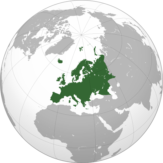
Tamanho desta visualização em PNG deste arquivo em SVG: 537 × 536 pixels. Outras resoluções: 240 × 240 pixels | 481 × 480 pixels | 769 × 768 pixels | 1 026 × 1 024 pixels | 2 052 × 2 048 pixels.
Imagem numa resolução maior (arquivo SVG, de 537 × 536 pixels, tamanho: 77 kB)
Histórico do arquivo
Clique em uma data/horário para ver como o arquivo estava em um dado momento.
| Data e horário | Miniatura | Dimensões | Usuário | Comentário | |
|---|---|---|---|---|---|
| atual | 13h32min de 4 de setembro de 2022 |  | 537 × 536 (77 kB) | wikimediacommons>M.Bitton | Reverted to version as of 12:03, 4 September 2022 (UTC): per COM:OVERWRITE |
Uso do arquivo
Mais de 100 páginas usam este arquivo. A lista a seguir mostra a primeira página que usa apenas este arquivo. Uma lista completa está disponível.
- Acordo de Munique
- Alemanha
- Amesterdão
- Andorra
- Arménia
- Atenas
- Banco Central Europeu
- Barcelona
- Berlim
- Bielorrússia
- Brasão de armas da Croácia
- Brasão de armas da Suécia
- Bruxelas
- Bucareste
- Budapeste
- Bulgária
- Bélgica
- Campeonato Europeu de Futebol de 2004
- Chipre
- Chéquia
- Comissão Europeia
- Congresso de Viena
- Constantinopla
- Copenhaga
- Croácia
- Dinamarca
- Dublin
- Eslováquia
- Eslovénia
- Espanha
- Estocolmo
- Estónia
- Euro
- Europa
- Europa Ocidental
- Finlândia
- Frankfurt am Main
- França
- Grã-Bretanha
- Grécia
- Guerra dos Camponeses
- Hamburgo
- Helsínquia
- História da Europa
- Hungria
- Idade Média
- Império Romano
- Independência
- Irlanda
- Istambul
- Itália
- Kiev
- Kosovo
- Letónia
- Lisboa
- Lituânia
- Londres
- Luxemburgo
- Língua albanesa
- Línguas indo-europeias
- Macedónia do Norte
- Madrid
- Malta
- Mar Báltico
- Mar Mediterrâneo
- Mar do Norte
- Marselha
- Milão
- Moscovo
- Munique
- Mónaco
- Ordem dos Templários
- Paris
- Parlamento Europeu
- Partido político europeu
- Países Baixos
- Península Ibérica
- Polónia
- Portugal
- Praga
- Reforma Protestante
- Reino Unido
- República Turca de Chipre do Norte
- Roma
- Romênia
- Rússia
- San Marino
- Solução final
- Suécia
- Suíça
- Sófia
- Tallinn
- Torre Eiffel
- Turquia
- Ucrânia
- União Europeia
- Varsóvia
- Viena
- Vikings
- Vilnius
Ver mais links para este arquivo.


 " class="attachment-atbs-s-4_3 size-atbs-s-4_3 wp-post-image" alt="O que estudar para o enem 2023">
 " class="attachment-atbs-s-4_3 size-atbs-s-4_3 wp-post-image" alt="Qual melhor curso para fazer em 2023">
 " class="attachment-atbs-s-4_3 size-atbs-s-4_3 wp-post-image" alt="Enem: Conteúdos E Aulas On-Line São Opção Para Os Estudantes">
 " class="attachment-atbs-s-4_3 size-atbs-s-4_3 wp-post-image" alt="Como Fazer Uma Carta De Apresentação">
 " class="attachment-atbs-s-4_3 size-atbs-s-4_3 wp-post-image" alt="Como Escrever Uma Boa Redação">
 " class="attachment-atbs-s-4_3 size-atbs-s-4_3 wp-post-image" alt="Concurso INSS edital 2022 publicado">


