Tamanho desta previsualização: 800 × 351 pixels. Outras resoluções: 320 × 140 pixels | 640 × 281 pixels | 1 425 × 625 pixels.
Imagem numa resolução maior (1 425 × 625 pixels, tamanho: 42 kB, tipo MIME: image/png)
Descrição do arquivo
| Descrição |
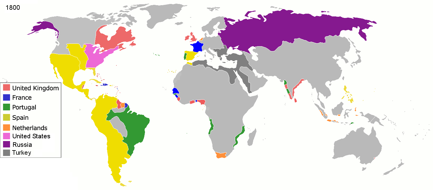
English: Colonial empires in 1800 Français : Empires coloniaux en 1800 Español: Imperios coloniales en 1800 Português: Impérios Coloniais em 1800
United Kingdom
France
Portugal
Spain
Netherlands
United States
Russia
Turkey
|
||||||||||||||||
| Data | |||||||||||||||||
| Fonte | Trabalho próprio pelo carregador | ||||||||||||||||
| Autor | Jluisrs | ||||||||||||||||
| Permissão (Reutilizando este arquivo) |
|
||||||||||||||||

|
File:Colonial empires in 1800.svg é uma versão vetorial desta imagem. Ela deve ser usada no lugar desta imagem rasterizada, se não for de qualidade inferior.
File:Colonisation 1800.png → File:Colonial empires in 1800.svg
Para mais informações, consulte Ajuda:SVG. |
 |
| Annotations | This image is annotated: View the annotations at Commons |
Histórico do arquivo
Clique em uma data/horário para ver como o arquivo estava em um dado momento.
| Data e horário | Miniatura | Dimensões | Usuário | Comentário | |
|---|---|---|---|---|---|
| atual | 19h28min de 1 de maio de 2016 | | 1 425 × 625 (42 kB) | wikimediacommons>Mega-light | Dominican Republic was a French colonia between 1795 and 1808 through Treaty of Basilea. |
Uso do arquivo
As seguinte página usa este arquivo:
 " class="attachment-atbs-s-4_3 size-atbs-s-4_3 wp-post-image" alt="O que estudar para o enem 2023">
 " class="attachment-atbs-s-4_3 size-atbs-s-4_3 wp-post-image" alt="Qual melhor curso para fazer em 2023">
 " class="attachment-atbs-s-4_3 size-atbs-s-4_3 wp-post-image" alt="Enem: Conteúdos E Aulas On-Line São Opção Para Os Estudantes">
 " class="attachment-atbs-s-4_3 size-atbs-s-4_3 wp-post-image" alt="Como Fazer Uma Carta De Apresentação">
 " class="attachment-atbs-s-4_3 size-atbs-s-4_3 wp-post-image" alt="Como Escrever Uma Boa Redação">
 " class="attachment-atbs-s-4_3 size-atbs-s-4_3 wp-post-image" alt="Concurso INSS edital 2022 publicado">


.jpg)
._LOC_2001620596.jpg)